
Spring Feature Project -
Fire and Flood in Nariel and Corryong Creeks

Nariel Creek
As you know, the Summer of 2019/2020 marked the most intense bush fires Australia has experienced since European settlement. In the Nariel Creek, in the Upper Murray, 98% of the forested catchment was burnt to some extent. As a double blow for the region, heavy rain after the fires caused flooding that adversely affected the creeks and surrounding land and assets.
In the months since these fires, Streamology teamed up with Prof. Ian Rutherfurd of the University of Melbourne, to undertake a geomorphological assessment of the Nariel Creek to quantify the likely trajectory of change within the systems as a result of the catastrophic fires and subsequent floods, and to provide management plans and recommendations to the North East Catchment Management Authority about how best to manage ongoing impacts.
Context - Fires destroy healthy vegetation and root matter and burning causes hydrophobic soils, resulting in hillslopes that are less able absorb the rain that falls on them, delivering larger volumes of water into the river system (in a shorter time) for a given rain event.
This occurred in the Nariel and Corryong catchments, with a heavy rain event occurring 2 months after the fires, followed by a larger flood (1 in 6 year ARI) on the 30th of April, causing substantial geomorphic change (erosion and deposition) in the creeks. As a result of these events, a large pulse of sediment and organic material from the fire eliminated most fish from the creek, and reduced the water quality significantly.
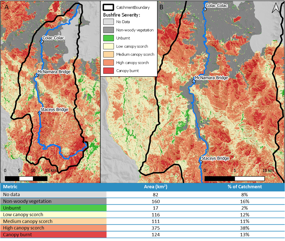
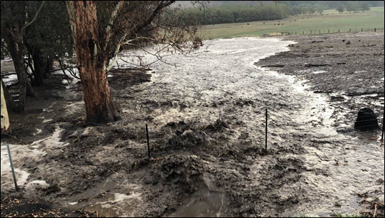
The assessments of the creeks revealed that currently, minor storm events can result in mass erosion and flooding, despite a century of intense management efforts. The cause of this issue is that the creek holds too much flood energy as a result of the historic straightening and realigning of the creek channel, as well as the removal of a large percentage of vegetation and instream woody habitat along the creek.
Normally, rivers dispel energy to reach a state of dynamic equilibrium by sinuously winding through the landscape, with woody habitat and instream sediments balancing the rivers erosive powers. Without these key features, channels can become highly erosive and prone to overbank flooding, incision, and avulsions, such is the case in the Nariel and Corryong Creeks.
Field Work
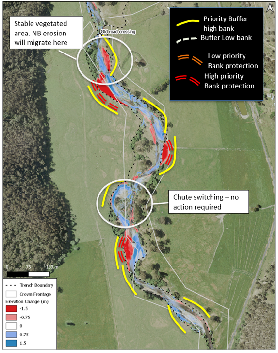
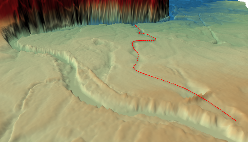
Thom and Ian spent some time in the field assessing the geomorphic condition post-fires and floods in person and via drone. Closer inspection of the banks revealed significant erosion, and the limitations of the historic management interventions.
They were able to quantify the changes occurring within the creeks by developing digital elevation models of difference (DEMOD), highlighting areas of the creek which have been experiencing erosion and deposition. This information is vital to predict the likely channel trajectory, and to propose viable management solutions to help rehabilitate the creek. The figures above highlight recommended interventions better manage erosion of crown land and high-value grazing land, and an annotated map discussing the geomorphic processes transforming the creek.
Take home messages
Fire and flood play significant roles in the shaping of Australian Rivers and the wider landscape. What is often understated is the impact of historic management on rivers, as some of these past decisions are starting to impact the condition of waterways today.
New geomorphic understanding of the implications of past management approaches marks an opportunity for the industry today to learn and grow, to improve the benchmark for waterway management. Our report outlines several such opportunities for the north east catchment, and speaks to how informed management based on an intimate knowledge of how the system operates can allow rivers to become more stable environment for biota.